🔴 Website 👉 https://u-s-news.com/
Telegram 👉 https://t.me/usnewscom_channel
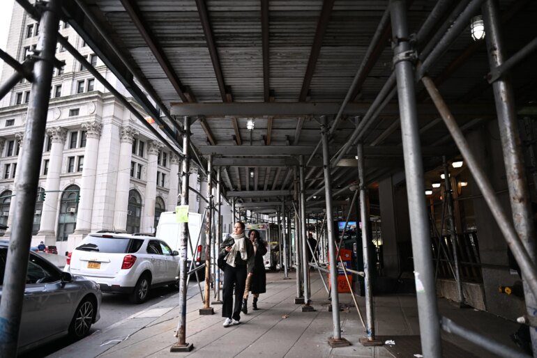
Built to protect pedestrians from falling debris, the ubiquitous sidewalk shed has become an unfortunate defining feature of New York City life.
And while we can applaud the new, improved designs for these eyesores, we need to get smarter about how to keep fewer of them up and for shorter periods of time.
Simply making sidewalk sheds prettier is merely putting “lipstick on a pig” — no offense to pigs. We can do better.
As of last year, the city had more than 8,000 active sidewalk shed permits on file.
More than 400 have been up for more than half a decade; an infamous one in Harlem was up for 21 years before finally being taken down in 2023.
What was meant to be temporary safety infrastructure has metastasized into a chronic urban condition.
They block light, hide storefronts, limit accessibility for people with disabilities and provide cover for rats, trash and illicit activity.
And they’re ugly.
The last administration vowed to “Get Sheds Down,” but good intentions alone haven’t dismantled a broken system that is just too slow and bureaucratic.
We’re hoping the Mamdani administration sees the problem isn’t just about prettier steel poles and plywood; it’s about data.
Currently, the Department of Buildings lacks an up-to-date, comprehensive picture of which sheds are up, which are expired and which were never permitted in the first place.
Scaffold inspections remain manual, complaint-driven and slow.
Data on something as visible and dynamic as scaffolding is astonishingly static.
Researchers at Cornell Tech have a novel solution.
A team led by Prof. Wendy Ju used 29 million dashboard-camera images provided by Nexar, Inc. to “fingerprint” New York’s scaffolding problem.
Nexar’s images come from the vantage of thousands of vehicles equipped with cameras, mostly ridesharing vehicles.
By training an artificial-intelligence model to detect scaffolds in street-level images and matching them with DOB permit data, the team was able to map where sidewalk sheds appeared, disappeared or overstayed their welcome over time.
The results are eye-opening: The researchers confirmed more than 5,000 active permitted sheds and an estimated 500 unpermitted or expired ones — nearly 10% of the total.
Using this approach, the city could continuously monitor the lifecycle of every sidewalk shed, from installation to removal, without sending inspectors out block by block.
It could finally see the scope of the problem, along with specific locations, in real time.
This kind of urban-scale monitoring — where cities use technology to observe themselves — represents a profound shift in how we manage public life and assets like city streets.
Rather than waiting for complaints, we can use data to prioritize inspections, enforce regulations and, most important, improve the daily experience of residents.
Cornell Tech has already demonstrated how this approach can empower both government and residents. Our “Treefolio” project, a partnership with Cornell’s Design Across Scales Lab, built an interactive “digital twin” of the city’s street tree canopy.
The model combines the city’s open data, LiDAR mapping models and other visualization tools to let any New Yorker explore and advocate for better tree coverage in their neighborhoods.

The platform transforms raw data into a tool for civic empowerment.
Imagine a similar tool for scaffolding: a public-facing “Shedfolio” that lets anyone see how long a sidewalk shed has been up, whether it has a valid permit and when it is scheduled to come down.
Residents could report discrepancies, journalists could track abuse and the DOB could focus its limited resources where needed most.
Some might gripe that increased camera monitoring contributes to an ever-expanding surveillance state.
Yet the images would capture views that are already out in the open, often already widely available.
Plus, they can be handled with robust privacy safeguards.
The end product would be a powerful management tool: Every roving taxi or rideshare could passively contribute to a living map of the city’s infrastructure — sidewalk sheds today, potholes and streetlights tomorrow.
To get there, the DOB should partner with academic researchers and leading computer-vision technology companies to help better monitor and maintain public assets.
We could turn cutting-edge research into a practical system for identifying expired or unpermitted scaffolds and other infrastructure, visualizing citywide patterns and accelerating safe takedowns.
It would be a tangible step toward smarter, more accountable governance — something every New Yorker could literally see and feel on their daily walk.
Michael Samuelian is the founding director of the Urban Technology Hub at Cornell Tech, where Matthew Franchi is a PhD candidate in computer science.